Saturday, July 31, 2010

How the Arctic search team found HMS INVESTIGATOR


The Mercy Bay encampment with a nearby grave site, Jul. 27, 2010. The HMS Investigator, whose crew discovered Canada’s Northwest Passage has been found 155 years after it was abandoned and disappeared in this isolated Arctic bay.
Don Martin/National Post
The Mercy Bay encampment with a nearby grave site, Jul. 27, 2010. The HMS Investigator, whose crew discovered Canada’s Northwest Passage has been found 155 years after it was abandoned and disappeared in this isolated Arctic bay.
Don Martin, National Post · Wednesday, Jul. 28, 2010
Dangling precariously over the side of a Zodiac while peering into the blue-green Arctic Ocean, the wreck of the ghost ship HMS Investigator suddenly looms large just eight metres below the surface.
The pointed bow, the flat stern splintered long ago by a passing iceberg, and a section of railing draped across the middle are easily visible to the naked eye despite the salt water. His hand cupped to block out the sun’s reflection, the usually restrained Environment Minister Jim Prentice excitedly tried to describe what he was seeing. All he could manage was a gushing stream of adjectives punctuated by a whole lot of “wows.”
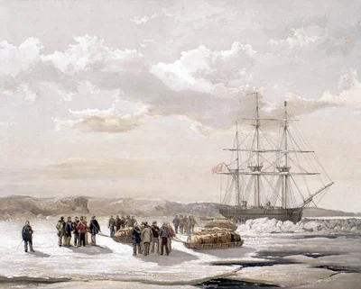
Goosebumps are inevitable when seeing a well-preserved wreck that is considered to be one of the most significant in the history of a country that didn’t exist when the British exploration vessel sank in 1855 after two deadly winters in this Banks Island Bay.
Until this week, no Canadian had set eyes on this incredibly well-preserved 36-metre, three-masted ship, which sank a year or so after being abandoned by Robert McClure and his crew, who are credited with finding the missing east-west link in the Northwest Passage.
The Parks Canada discovery last weekend happened almost too quickly for dramatic effect, perhaps befitting an archeological dig that is experiencing such an incredible streak of good luck on the water, on land and with the weather, the team is pinching itself in disbelief.
When a trio of Parks Canada archeologists took to their five-metre Zodiac earlier this week, dragging a torpedo-shaped Sonar gun behind them, they were prepared to spend two weeks scouring the bottom of the 30-metre-long bay. Even then, the odds of finding the Investigator were rated 50/50.
Spotting only one clear route through chunks of ice floating a few hundred metres off shore, they aimed their inflatable boat through the passage, flipped the switch to activate the Sonar, and turned their attention to the computer monitor.
The monochrome image almost immediately picked out bits of debris amid the deep gouges on the seabed before Canada’s echo of the Titanic discovery moment: The starboard of the Investigator appeared on the viewing screen.
The archeologists were sure they had it, but almost couldn’t believe a 10-month planning quest had succeeded so rapidly.
They made a second pass, then a third, a fourth, a dozen sweeps, and then — just one hour after they started — the team declared the Investigator found 155 years after it sank.
“Mercy Bay must feel like it got a bad wrap in the history books. It changed its nature and decided to be more merciful to us,” quipped Ryan Harris, a Parks Canada senior marine archeologist.
University of Western Ontario archaeologist Ed Eastaugh is scouring the land with magnetic scanners to record evidence of Investigator sailors who roamed the barren fields and fished the nearby lakes duringvwmore than two years trapped in the bay by thick ice.
His imaging team took just two days to find the three graves of British sailors who succumbed to sickness and starvation just a month before the boat was abandoned.
“You’re probably going to find a frozen body under there. This image [which shows up as three black rectangles against a faded background] suggests the bodies haven’t decomposed,” he said. “This was the needle in the haystack. This is what I had hoped to find above all else. I’ve never been on a project that has hit the principal goal so quickly.”
The giant cache of food, booze, barrels, pans and coal left behind by the Investigator crew before they walked to their rescue on the far side of nearby Melville Island has also been scouted and charted. A metal section holding a yard-arm in place and a metre-long piece of wood from the ship have been found on shore. Both items might be removed and taken to Ottawa for analysis and preservation.
Archeologists have also located a thousand-year-old Thule encampment on the far side of Mercy Bay, a rich deposit of tools amid hundreds of whale, caribou and seal bones. They hope to use the information gleaned from the site to plot and confirm the various migrations of indigenous people from Asia.
During a tour of the site yesterday, archaeologists showed me numerous bone fragments, a harpoon head and primitive tools found around the outlines of a large Thule dwelling and numerous food caches.
About the only setback so far was the temperamental behaviour of Little Bruce, a remote-operated vehicle the team lowered to video the wreck. It was reacting poorly to commands from the surface and the joystick will need to be replaced, but early glimpses of the wreck reveal the windlass and both anchor chains along with more detailed views of the deck.
The story appears to have captivated Britain, which still claims ownership of the wreck and the graves, almost as much as Canada.
The Environment Minister spent an entire morning fielding satellite calls from across the country, from international wire services, London newspapers and the BBC.

INVESTIGATOR wreck ready for its close-up - VIDEO SURVEY


Christopher Hunter/Handout
Jim Prentice and marine archaeologist Ryan Harris examine pictures of the wreck of the HMS Investigator
The roving remote camera Little Bruce drifted drunkenly over the bow of Investigator on Thursday, recording high-definition video just centimetres from the wrecked ship’s anchor chains and upper-deck planking scratched into rubble by 155 years of passing ice.
The images were a bit shaky because of a faulty joystick but, hey, just a week ago no one figured they’d even find this historic ship, which sank in eight metres of frigid water in 1855 after three winters locked in ice. Now a Parks Canada team of marine archaeologists has set out to video every centimetre of this incredibly well-preserved wreck and potentially have it ready for Internet downloading next week.
“Operating Little Bruce is like landing an airplane when the tail rudder’s been shot off,” sighed senior marine archaeologist Ryan Harris.
With Mercy Bay cleared of ice floes by a friendly southwest wind on Thursday under an unrelenting sun with temperatures in the teens, the team was prepared to work well past what would be nightfall in southern latitudes.
Up here, the sun never gets below five degrees at the horizon, a disorienting 24 hours of sunshine that allowed me to fish unsuccessfully until 2 a.m. last night and give me a final chance to end the drought late Friday before the field unit departs today.
But I digress.
While the team had appeared glum at first by the mechanical setback, Little Bruce’s handiwork has far exceeded anyone’s expectations.
“It’s nice to have a preview viewing so they don’t see us when we get all excited,” grinned Mr. Harris, before he screened the video for Environment Minister Jim Prentice. “OK, here comes the money shot.” Sure enough, as a colleague eased the camera behind the stern ripped open by ice, rudder attachments, copper plating and even grass marks on the hull appeared on the laptop monitor.
With the bulk of the hard work over, the scientific and cultural team members working this Banks Island Bay, 1,000 kilometres north of the Arctic Circle, are relaxed and starting to enjoy themselves immensely.
It may have been suggested as a joke, but when Mr. Prentice was asked whether he wanted to go snorkeling in the freezing Arctic water to check out the Investigator for himself, he jumped at it. Sporting a bloated black dry-suit but wearing a kid-in-a-candy-store smile, Prentice dropped into the freezing Arctic Ocean.
“It’s like looking into the 19th century, straight down into a museum,” said Mr. Prentice, as he bobbed beside the Zodiac, despite the leak in his suit. The next steps in the ship’s story are ensuring its continued survival because Mercy Bay, where it rests, is not within Auluvik National Park.
Mr. Prentice says he will negotiate an agreement with British authorities on the wreck (it’s technically still theirs) and see what they want to do about the three British sailors’ graves on the site.
Next up will be to pass heritage shipwreck regulations to protect all sunken vessels more than 50 years old.
The work has just begun for Parks Canada, which vows to send divers to the site next summer and perhaps engage in archaeological excavations of the land site.
“It’s far exceeded expectations,” says Western Arctic Seal Superintendent Ian Thomas. “We would have been happy to get up here and do a good survey of the cache area and at least find the ship than know where it wasn’t. Finding the ship, locating the graves and other work has made this phenomenally successful.”
The result is gratifying in light of the cost of the expedition. The cost just for the Auluvik Base Parks Canada unit is roughly $100,000, Mr. Thomas said. “Add in fuel and other transportation costs and the amount could easily double or triple.”

Thursday, July 29, 2010

HMS INVESTAGATOR found in Arctic after 162 years


A British ship abandoned in the Arctic in 1848 while on a rescue mission has been found intact in Canada.
Canadian archaeologists found the HMS Investigator under about 25 feet of pristine, icy water in Mercy Bay using sonar and metal detectors, the BBCreported.
The HMS Investigator, captained by Robert McClure, left Britain in 1848 to find a team led by Sir John Franklin who reportedly perished in the frozen Arctic while trying to find the Northwest Passage.
The Northwest Passage is a sea route through the Arctic Ocean, along the northern coast of North America, connecting the Atlantic and Pacific Oceans. McClure is credited as the first European to discover the western entrance to the Northwest Passage.
The crew of the Investigator abandoned the ship in the Canadian Arctic when it became trapped in ice. Running low on supplies and food, McClure and his men were eventually rescued by the Royal Navy.
"It's an incredible sight. You're looking at what people have not seen in 156 years, which is a remarkably intact British sailing vessel," Canadian Minister of Environment Jim Prentice was quoted as saying.
"You could make out all the planking on the deck, the details on the hull, all of the detail of the timber," he said. "It's sitting perfectly upright on the floor of the ocean."
The Canadian researchers also found three graves of British sailors.
Parks Canada, a government agency, will study the ship's artefacts but will not remove them, he said.


A team of Canadian archaeologists has found a British ship that has been missing in the Arctic for more than 150 years.
HMS Investigator left Britain in 1850 under the command of Captain Robert McClure.
It was on a rescue mission to find an earlier expedition led by Sir John Franklin.
But the Investigator became trapped in sea ice and was abandoned by crew members, who were rescued.
The vessel was located on Sunday with the help of sonar, just 15 minutes after workers from Parks Canada started looking.
It is about 11 metres from the surface, near Banks Island, in the west of the Arctic archipelago, where the crew abandoned ship in 1853 after spending three winters on the ice.
The wreck was described as being in good condition.
Marc-Andre Bernier, chief of underwater archaeology at Parks Canada, said the find was of utmost importance.
"This is the ship that sailed the last leg of the Northwest Passage and in doing so McClure and his crew were credited with finding the Northwest Passage," he said.
"It's the history of a crew of over 60 men that had to winter two times in the Arctic and being locked two years in the ice.
"So you can imagine the hopes and the (disappointment) of not seeing the ship being freed in the summer and not knowing if they were going to survive."
The next step will be to send down a robot equipped with cameras for a closer look.

Monday, July 26, 2010

Experts once again search for lost ships that marked end of Arctic passage


For the first time, Ottawa is trying to find a sunken 19th-century ship that helped discover the final leg of the Northwest Passage.
In January 1850, the HMS Investigator set sail from Britain under the command of Capt. Robert McClure.
He was on a mission to rescue Sir John Franklin, a renowned British explorer whose recent 129-man expedition had vanished while searching for a potentially lucrative trade route to connect the Atlantic and Pacific Oceans.
The Investigator entered Arctic waters from the west after travelling around the southern tip of South America. Like Franklin's expedition, the ship then became trapped in ice and the crew was forced to eventually abandon it. (The expedition was later miraculously rescued.)
McClure never discovered what befell Franklin, but he was credited with stumbling on the last uncharted section of the Northwest Passage -- which by then had eluded British explorers for 300 years.
Now, archaeologists with the federal government are trying to locate the historical vessel. It's believed to have sunk near the western edge of the Canadian Arctic archipelago.
McClure's expedition "kind of had a domino effect on the whole thing," said Marc-Andre Bernier, who is in charge of the Parks Canada archeologists seeking to uncover the Investigator's resting place.
On Thursday, the team arrived at a cache of supplies that McClure had deposited on the shore of what he dubbed Mercy Bay.
They set up a camp that includes an electric fence and is watched over by Inuvialuit wildlife monitors to protect them from roaming polar bears.
A few hundred metres off shore, the archeologists then set about mapping the seabed using side-scan sonar. If they find anything unusual or "shipwreck-like," they'll dispatch a miniature robotic submarine with a camera attached to verify the find.
"Cold water is very good for preservation," Bernier said by phone from Ottawa. "If the water is fairly deep, then we might have some fairly intact structure."
"There are other instances of wrecks found in the arctic in fairly good condition," he added.
Due to the remoteness of the site, which lies in what is now Aulavik National Park on Banks Island, the archeologists have no means of communication save for a satellite phone to be used only in case of emergencies. So news of their discoveries won't be known until early August when they return to the mainland.
Another trip is planned later in August to locate Franklin's two lost ships -- both of which have been deemed National Historic sites -- off the coast of Nunavut.
Bernier said the timing of the searches has to do with the opening up of the Northwest Passage.
"There are a number of sites in the Arctic like this," he said. "We want to make sure they're protected."
"There's more water free of ice every year… There are more visitors in the Arctic. There's more boat traffic."

Lost in the Canadian Arctic, two British polar exploration ships more than 150 years old are frozen in some icy nook and cranny.
Despite more than 30 search and rescue missions for Captain Sir John Franklin and his crew, only scraps of evidence -- forks and spoons, shoes, a letter -- have been found of the 1845 expedition.
Now a team of Canadian archaeologists is setting off with modern sonar sea-floor mapping instruments, along with historical records to locate HMS Terror and HMS Erebus, reports a BBC News article. The researchers hope to finally piece together what happened to the shipwrecked crew.
Veteran explorer Franklin led two ships and 128 men north in search of the legendary North-West Passage -- a narrow channel that connects the Pacific and Atlantic oceans.
The existence of such a channel would revolutionize trading; ships would no longer need to circumnavigate around the Americas to reach the West Coast or Asia. For this reason, the Royal Navy was offering a £10,000 reward for finding the North-West Passage.
The passage was eventually discovered by Captain Robert McClure in 1855 during a failed rescue mission for Franklin’s crew. Today ships can use the iceberg-filled pathway, but only in the dead of summer.
When Franklin set off on his final voyage, he was motivated by the prize money, adventure and glory. No stranger to the harsh, cold conditions of the Arctic, Franklin had already mapped 1,200 miles of Canadian coastline on previous expeditions.
The crew outfitted the front tips of HMS Terror and HMS Erebus with iron so the ships could bust through any icy barriers. The ships also featured the latest technology at the time -- small steam engines.
But the Arctic proved a formidable foe. The ships crashed, and whether due to lead poisoning from poorly packaged food, scurvy or simply not enough food, the entire crew perished.
Interviews with Inuits during early rescue missions revealed that some members of the crew got crazed and desperate, resorting to cannibalism. 
The mystery of how all the explorers died is one of the many questions the Canadian archaeologists hope to resolve. 
The archaeologists are following the same sea route used by Franklin and his crew in 1845: entering the Arctic from the East and maneuvering past Greenland into the vast Canadian Arctic archipelago.  
The team is basing their search on the few clues researchers have already accumulated. For example, the location of the shipwreck is suspected to be somewhere along Mercy Bay and could be marked by debris of the wreck, including a pile of coal.
If the investigation in Mercy Bay proves unfruitful, the team plans on flying more than 621 miles east to another potential crash spot. In this second location, west of the Adelaide Peninsula, the archaeologists hope to survey the sea floor for remnants of the ships.
And maybe, fingers crossed, this will be the final search mission for Franklin and his crew.


2010 Challenging ice conditions in the Arctic this Season - FIRST WEEK OF SEPTEMBER NORTHWEST PASSAGE SHOULD BE MINIMUM ICE

Several sailboats will try to go through the Northwest and Northeast Passage this Arctic summer. It is not a given that they succeed, says Arctic ice expert and adventurer Knut Espen Solberg.

Norwegian Knut Espen Solberg is one of the foremost experts on Arctic ice conditions, and through his work as a senior Polar researcher at DNV, he follows closely what is happening in the world's northernmost waters. He has over wintered two times in Greenland in an effort to sail the Northwest Passage, and spent several summers after that doing research in the area.

He is also running the company Fotspor.org who focuses on climate research and expeditions in the Arctic.

Explorersweb's Jon Amtrup talked to him before departure, and will also do a follow up article on the boats that are about to try to sail the Northwest and the Northeast Passage this summer.

Solberg is now on his way back to Greenland in their boat, Jotun Arctic, to survey ice conditions.

- The inland ice on Greenland appears to melt and run into the sea much faster than the increase in air temperature, a result of climate change, would suggest. We wish to find out is some of the warm water of the Gulf Stream has found its way in to the Greenland fjords, and whether this contributes to increased melting of the bottom of the glacier, he says, and continues;

- Predicting ice conditions that will meet the yachts in the Arctic this summer is very difficult. Ice conditions in the different areas are not only based on the meltdown. Current and wind can quickly blow polar ice into the open areas where you think you can get through, says Knut Espen Solberg.

There is however some trends that could indicate a certain development for the boats that is now on their way in to the Arctic:

• In May "Arctic Gyre" (see illustration) was situated far west (to Alaska) in the Polar basin. This causes the ice off Alaska and western Canadian Arctic to set itself in motion towards Russia.
• There is moderate ice transport south of the Arctic through the Fram Strait.
• Low ice thickness (on average about 20 inches less than normal in large parts of the Arctic) and higher than normal temperatures are expected across much of the Arctic during the summer. This will cause a relatively rapid melting of ice.
• Small several year ice located in the southern area around the North West Passage bottleneck. This would indicate a relatively early opening of the passage.
• There is a lot of multi-year ice northwest of the Northwest Passage bottleneck (Peel/Larsen Sound). If there are northern winds, when the passage opens, this ice can quickly drift into the passage and close it.

- This indicates little ice and early open waters in the western part of the Northwest Passage. The ice in the eastern part of the passage is likely to melt quickly, but old multi-year ice can drive down and fill the passage again. This depends on the wind direction in the period immediately after the melting has taken place.

When it comes to the Northeast Passage, where the Russian Peter 1 and Norwegian Børge Ousland are trying to get through, he says:

- At present there is little to suggest that there will be another record year for low ice concentration of ice in the Northeast Passage, and the sailors will probably be dependent on the southerly winds to achieve a clear passage.

- The very latest update show (see illustration in Link section): ) that the melting process has slowed down for the last weeks compared to the last couple of years. The ice extent is currently about 1 mill square km above the record low experienced in 2007, at about the same level as in 2008 and 2009. It is however important to note that clearing the passages is not only a question of how much ice is present in the Arctic, but it is as much a question of the location of the ice.

- The least ice extent is not achieved until mid-September, and a lot can still happen. Although in recent years there has been considerably less ice in the Arctic summer season. This does not mean that the development and sailing in the Arctic, however, is not easy because the polar ice is seldom at rest. Wind can quickly carry the ice southward into to open waterways and fill the bays and straits, says Knut Espen Solberg. 


IMPORTANT LINKS:
http://arctic-roos.org/observations/satellite-data/sea-ice/ice-area-and-extent-in-arctic
http://iup.physik.uni-bremen.de:8084/amsr/amsre.html
http://iup.physik.uni-bremen.de:8084/amsr/arctic_AMSRE_nic.png

Monday, July 19, 2010

Kenai Red Sockeye Salmon Expedition


Kenai Reds Expedition

Judy and I went on an expedition to catch Kenai River Sockeye salmon this week. Kelly Walters talked us into it.

I've always avoided going down to the Kenai River at the peak of the Red run, because of the thousands of people who congregate to catch hundreds of thousands of fish. Judy and I were spoiled from our ten years on Prince William Sound. Initially, from 1973, I fished Area E (Prince William Sound, the Copper and Bering River deltas, and the northern tip of the Gulf of Alaska) commercially as a gillnetter, so we had all the Sockeye we needed. After 1979, I no longer gillnetted. However, during that time, we could take one of our boats to Coghill River, Eshamy River or Jackpot Bay for their Sockeye runs. Sometimes, at Coghill River, we might be the only people fishing from the shore, as thousands of Sockeye coursed up the river.

Kelly was persuasive, though. He talked up his trip there last year. My son Alex and Kelly had fished the Copper River canyon together in 2009. Alex told me Kelly was an awesome fishing partner, so I decided to convince Judy to come along too.

We left late Thursday evening, drove to the Kenai public boat launch ramp parking lot, and slept a bit. Then we launched our 17-foot Klamath early Thursday morning.

The fishing was a bit slow. Kelly had the appropriate net for Kenai. We had stuff for the Copper River, or homemade nets for the now-defunct Fish Creek dipnet fishery. Our stuff wasn't very effective. Kelly was catching almost all the fish. By 2:00 we had about 30 Reds.

About then, I found out that 2-cycle outboard motors, like my ancient Evinrude 35-HP kicker, are no longer allowed on the Kenai. I'd never been on the river with my boat, and didn't know that. I wanted to head back to the launch ramp, not wanting to be fined. On the way back, the fish hit.

About an hour before the low water change of tide, our nets - including Judy's - began to get hits. Lots of them. Judy started getting two fish at once; Kelly was sometimes getting three. Very quickly, we had a boat full of salmon.

And the fish were hitting everywhere around us. The change-of-tide waters were very disturbed, as wind, current and tide all collided, forming tall waves, spaced close together. The combination of these elements, plus the frenetic efforts of everyone to quickly clear their nets, to get them back into the river, was exhilirating. Judy, who had been frustrated by slow fishing earlier in the day, was now pumped up, enjoying how weirdly exciting all this action was.

As soon as the flood tide began, the fish stopped hitting. Not just our nets. Everyone's. The waters calmed. The current began flowing upstream. We picked up the nets and headed to the launch ramp.

Here are some more pictures:


Kelly in the bow

Fish on the floor boards

Outdoor Dream trip takes 16-year-old on Alaska fishing expedition


 — The only things Brandon Tollack shot on a recent hunting trip to Alaska were sunsets and fishing holes, with his camera.
He did hook a few fish. The 16-year-old traveled to Alaska June 27-July 5 on a trip sponsored by the Outdoor Dream Foundation.
Brandon was found to have Hodgkin’s lymphoma in May 2009. His father accompanied him on the trip, along with his sponsor, Mary Beth Parker, and her friend.
He fished for three varieties. First, he and his father caught 200 pounds of halibut at Cook Inlet. Tries at sockeye salmon and king salmon weren’t as successful.
But he prefers halibut, which has a “gourmet” kind of taste.
To Parker, halibut is a little more common.
“It looks like a big flounder,” she said.
Brandon, of Powdersville, chose Alaska for his expedition after hearing about it from his father, James, who was stationed there in the military. Before Alaska, Brandon’s father had taken him to Sumter and New Jersey to fish.
Oregon, Wyoming, Hawaii and the Bahamas are some of the states the Outdoor Foundation has sent children to hunt and participate in other outdoor adventures. Coach Harold Jones and his son, Brad Jones, started the foundation in 2004 to fulfill the hunting wishes of children with terminal or life-threatening illness. At 6:30 p.m. on Tuesday the foundation will hold a fundraiser at the Watkins Community Center in Honea Path.A $25 ticket covers dinner, a live auction and a raffle.Former NASCAR racer Hank Parker Jr., no relation to Mary Beth Parker, will host the fundraiser. Parker is the son of Hank Parker, winner of the Bassmasters Classic.
Brad Jones said the foundation hopes to earn $18,000 at the fundraiser.
The foundation helps children from all over the country, but mostly works with hospitals in South Carolina. Jones said his father is no big hunter, but his uncles took him hunting when he was a boy.
A big motivation for starting the foundation was “just to see those children smile,” he said. “Some of them don’t have a whole lot to smile about. It puts a smile on their face.”
Mary Beth Parker, 38, had volunteered for the Outdoor Dream Foundation since it began in 2004.
Then her brother died of kidney cancer in 2006 at 32.
“I was already volunteering for the foundation, but that just made me want to do more,” said Parker, who is Jones’ cousin.
To do more, she decided to become a sponsor. Brandon is the second patient she’s sponsored.
Her reason for mentoring is similar to Jones’.
“I just love the look on their faces when they do something they’ve never done,” said Parker, a biomedical engineer. “They look at life from a different perspective than a child who doesn’t have a life-threatening illness. They appreciate life more.”
Brandon especially appreciated the natural landscapes in front of him.
“Brandon is really interested in photography,” Parker said. “We spent a lot of time just sightseeing. You can’t pick a much better place to go to practice your photography than Alaska.”
The teen is attending a summer camp at Greenville Memorial Hospital for children who are undergoing or have gone through cancer treatment. The experience is teaching him how cancer can affect a child.
“It’s a little bit surprising about how many kids there are younger than 11 here,” he said.
Brandon, whose disease has been in remission since 2009, plans to apply to Clemson University after high school


What: An Evening with Hank Parker Jr., a fundraiser for the Outdoor Dream Foundation
When: 6:30 p.m., Tuesday
Where: Watkins Community Center, Honea Path
Contact: For tickets, call Coach Harold Jones at 226-8775

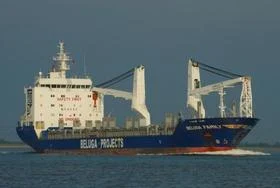
BELUGA First through Northeast Passage


Simultaneously as climate scientists can see a near record low sea ice in the Arctic, two German merchant vessels are the first ever to make it through the formerly impenetrable Northeast Passage.


The German shipping company’s two vessels have reached their destination of Novy Port in the outlet of the Ob River after they sailed from Ulsan in South Korea in August. End of August and beginning of September is the time of the year with minimum ice along the northern coast of Siberia.
The last updated data from the National Snow and Ice Data Centre shows that the averaged sea ice extent in the Arctic over August 2009 was 6,26 million square kilometres. That is 1,41 million square kilometres below the 1979 to 2000 average.
The two German commercial vessels to be the first to sail the route all the way through the Arctic from east to west are now delivering their cargo, 44 modules with single weight of 200 tons or more, onto barges in the Ob River reports HeavyLift. Then the two ships will sail around the Yamal Peninsula, cross the Barents Sea to Murmansk and head on to Rotterdam with its remaining 3,500 freight tons, writes HeavyLift.
The vessels, belonging to the Beluga Group, are of ice class and this year’s voyage comes after long time planning and a delayed permission to sail the route from Russian authorities. The voyages were first intended to take place last year as reported by BarentsObserver.
Following the climate changes and rapidly decreasing sea ice in the Arctic, there is a growing interest in Arctic Shipping. Two years ago, the first dry bulk cargo vessels made it through the Northwest Passage from Murmansk to Canada. The Russian vessel Kapitan Sviridov was the first to sail the western Arctic route, loaded with fertilizers from the Kola Peninsula, as reported by BarentsObserver.


Sunday, July 11, 2010

Russia's sailing ship heads for the Arctic


The four-mast sailing ship “Sedov” set sail from St. Petersburg on Saturday to explore the Russian continental shelf in the Arctic.
Captain Maxim Rodionov says the crew of the world’s largest sailing ship will have to cover nearly 5 thousand miles.
The “Sedov” will set course for Icelandic and Norwegian coasts and will call at Spitsbergen and Franz Josef Archipelago.
Built in 1921, the “Sedov” went down in the Guinness Book of Records as the biggest surviving sailing shop to date.


The Russian four-mast tall ship “Sedov” is about to set out from St. Petersburg on an expedition to far-away places, specifically to Iceland, Norway, the Spitsbergen archipelago and to Franz Josef Land.
The expedition is in memory of the Soviet Northern Fleet seamen who died a heroic death when defending this country’s Polar Regions during the Great Patriotic War, and also in memory of the development of theRussian Arctic continental shelf.
The barque “Sedov” was built in Germany in 1921.
It was entered into the Guinness Book of Records as the largest sailing vessel that has defied the time challenge and is still in service.

Saturday, July 10, 2010

Battleship sailor tells Obama to shape up or ship out!

Battleship sailor tells Obama to shape up or ship out!


This venerable and much honored WWII vet is well known in Hawaii for his seventy-plus years of service to patriotic organizations and causes all over the country. A humble man without a political bone in his body, he has never spoken out before about a government official, until now. He dictated this letter to a friend, signed it and mailed it to the President.

Dear President Obama,

My name is Harold Estes, approaching 95 on December 13 of this year. People meeting me for the first time don't believe my age because I remain wrinkle free and pretty much mentally alert.

I enlisted in the U.S. Navy in 1934 and served proudly before, during and after WWII retiring as a Master Chief Bos'n Mate. Now I live in a "rest home" located on the western end of Pearl Harbor, allowing me to keep alive the memories of 23 years of service to my country.

One of the benefits of my age, perhaps the only one, is to speak my mind, blunt and direct even to the head man.

So here goes.

I am amazed, angry and determined not to see my country die before I do, but you seem hell bent not to grant me that wish.

I can't figure out what country you are the President of.
You fly around the world telling our friends and enemies despicable lies like:
"We're no longer a Christian nation"
"America is arrogant" - (Your wife even announced to the world,
"America is mean-spirited." Please tell her to try preaching that nonsense to 23 generations of our
war dead buried all over the globe who died for no other reason than to free a
whole lot of strangers from tyranny and hopelessness.)

I'd say shame on the both of you, but I don't think you like America, nor do I see an ounce of gratefulness in anything you do, for the obvious gifts this country has given you. To be without shame or gratefulness is a dangerous thing for a man sitting in the White House.

After 911 you said, "America hasn't lived up to her ideals."

Which ones did you mean? Was it the notion of personal liberty that 11,000 farmers and shopkeepers died for to win independence from the British? Or maybe the ideal that no man should be a slave to another man, that 500,000 men died for in the Civil War? I hope you didn't mean the ideal 470,000 fathers, brothers, husbands, and a lot of fellas I knew personally died for in WWII, because we felt real strongly about not letting any nation push us around, because we stand for freedom.

I don't think you mean the ideal that says equality is better than discrimination. You know the one that a whole lot of white people understood
when they helped to get you elected.

Take a little advice from a very old geezer, young man.

Shape up and start acting like an American. If you don't, I'll do what I can to see you get shipped out of that fancy rental on Pennsylvania Avenue . You were elected to lead not to bow, apologize and kiss the hands of murderers and corrupt leaders who still treat their people like slaves.

And just who do you think you are telling the American people not to jump to conclusions and condemn that Muslim major who killed 13 of his fellow soldiers and wounded dozens more. You mean you don't want us to do what you did when that white cop used force to subdue that black college professor in Massachusetts, who was putting up a fight? You don't mind offending the police calling them stupid but you don't want us to offend Muslim fanatics by calling them what they are, terrorists.

One more thing. I realize you never served in the military and never had to defend your country with your life, but you're the Commander-in-Chief now, son. Do your job. When your battle-hardened field General asks you for 40,000 more troops to complete the mission, give them to him. But if you're not in this fight to win, then get out. The life of one American soldier is not worth the best political strategy you're thinking of.

You could be our greatest president because you face the greatest challenge ever presented to any President. You're not going to restore American greatness by bringing back our bloated economy. That's not our greatest threat. Losing the heart and soul of who we are as Americans is our big fight now. And I sure as hell don't want to think my president is the enemy in this final battle...

Sincerely,
Harold B. Estes

Note: Snopes confirms as true: http://www.snopes.com/politics/soapbox/haroldestes.asp <" href="http://www.snopes.com/politics/soapbox/haroldestes.asp%3E" target=_blank>http://www.snopes.com/politics/soapbox/haroldestes.asp>;

When a 95 year old hero of the "the Greatest Generation" stands up and speaks out like this, I think we owe it to him to send his words to as many Americans as we can. Please pass it on.

Saturday, July 3, 2010

ARCTIC OCEAN sea ice may be melted by August 8th this year


Leading ice expert says entire Arctic Ocean sea ice may be gone sometime between August 8th and September of this year.

Veli Albert Kallio, described by the UK Independent as a “leading ice expert”, has informed me (see his comment here) that at  the current melt rate all Arctic sea ice “would melt away by 8th August.”  Even if the melt rate slows down before August 8th the danger still persists.  Kaillo points out that  “there is still another 5 weeks that allow melting” after August 8th, and “ice in the Arctic Ocean could be all melted before the new winter freezes set in.”
Veli Albert Kallio
Kallio is not some crank, and needs to be taken seriously.  Besides being a “leading ice expert”, he is a fellow of the Royal Geographical Society, an invited speaker for the Religion, Science and the Environment movement, an International Guru Nanak Peace Prize Nominee for 2008, and founder of the Frozen Isthmuses’ Protection Campaign of the Arctic and North Atlantic Oceans.
He has applied the same keen insight to the Arctic sea ice that he applies to his search for Atlantis.
Here are the numbers, as reported to me by Kellio:
“The Arctic Ocean sea ice has been declining since summer solstice at rate of 170,000 square kilometres per day. For example, over the last weekend Friday to Sunday 25-27 June the sea ice area decreased 516,000 square kilometres, which equals at 170,000 km2 per day. The highest daily melting was 25.6 at 208,000 km2 of which 112,000 km2 occurred above the normal 1979-2008 melting.”
I was shocked and dismayed to hear this news.  I immediately checked theAMSR-E data for arctic sea ice   to onfirm his results.  I plotted the average Arctic sea ice extent for each day of the year covered by the AMSR-E data (2002 to present) and added one standard deviation, and overlaid the 2010 data.  Then I overlaid a slope of -170,000 km2/daypassing through June 25 and June 27th and extapolated out to the future.  And to my horror, it looks like Kallio is right!!  See for yourself…

Friday, July 2, 2010

Oceania's last glaciers have just a few years left, scientist says


The last glacier remnants in Indonesia are tiny -- just a square mile total -- lying 16,500 feet above sea level on the equatorial island of New Guinea. They're largely a mystery to science because of the region's inaccessibility and violent political unrest. An Ohio State University glaciologist who recently made the first scientific expedition to the Puncak Jaya ice cap in almost 40 years found it in extremely rapid retreat. "These glaciers are dying," Lonnie Thompson told The Associated Press. "Before I was thinking they had a few decades, but now I'd say we're looking at years."

For [Thompson], the Papuan glaciers, because they lie along the fringe of the world's warmest ocean and could provide clues about regional weather patterns, were an unexplored "missing link."
It is this region that generates El Nino disturbances and influences climate from India's monsoons to the Amazon's droughts. As such, it is one of the only "archives" about the story of the equatorial phenomenon. ... It also could point to what lies ahead for billions of people in Asia.


Thompson says global warming has already destroyed much evidence in the form of dust deposits captured within the glacier that have been lost to melting.

Click this link for more photos of the Puncak Jaya ice cap from Thompson's expedition and this one for the expedition blog posts. Thompson has also researched Alaska glaciers.